简体中文
简体中文

Dozens of people have died and many are still missing after a devastating flood in the Himalayan area of Chamoli in Uttarakhand, northern India.
The deluge left the Rishiganga hydroelectric power project almost entirely buried under mud and ice. Another dam project on the Dhauliganga River was also severely damaged.
Disasters of this kind are becoming more frequent in the Himalayas, with many scientists pointing to rising temperatures as one of the causes.
A 2019 study by Columbia University's Lamont-Doherty Earth Observatory (LDEO) found that Himalayan glaciers are melting at twice the rate they were two decades ago.
Using satellite imagery, scientists have been piecing together what happened.
Nanda Ghunti mountain sits high up in the Nanda Devi National Park. This is a satellite image showing the mountain range before the disaster.
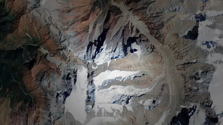
Image:Nanda Ghunti mountain. Pic: Google Earth
At roughly 5,600 metres, a crack had formed on the side of the mountain. Researchers monitor images to try to identify any changes, but it can be difficult.
The crack can just about be seen in this satellite image of the peak, which was captured on 2 February - five days before the disaster.
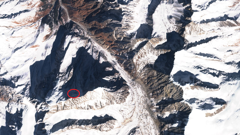
Image:A crack had formed in the flank of the peak. Pic: SentinelHub
The horizontal line of the crack is much more visible when the satellite is zoomed in, as shown in this picture.
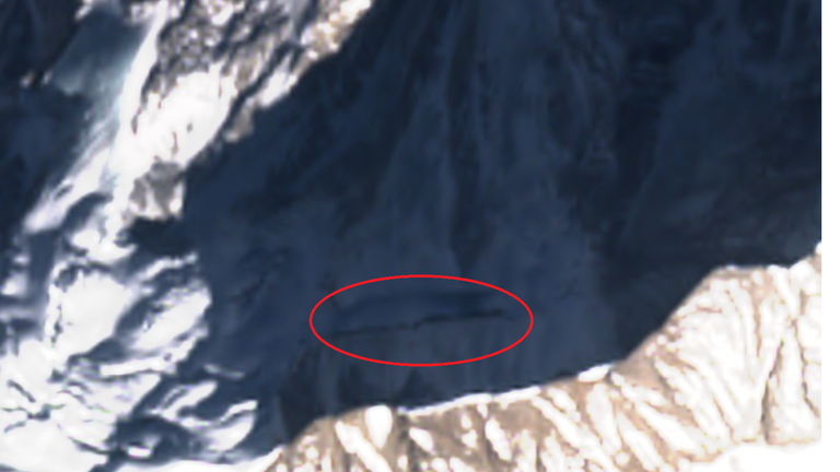
Image:This close-up shows the crack more clearly. Pic: SentinelHub
Using satellite imagery, it is possible to see that the crack has been developing for some time - with evidence of the crack first being visible in this image from 1 January 2020.
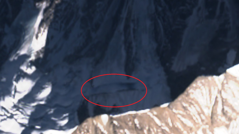
Image:This zoomed in satellite image shows the crack on 1 January 2020. Pic: SentinelHub
Scientists believe it was this crack that caused an enormous block of rock and ice to fall into the valley on 7 February.
It's estimated that the block was over 2 million cubic metres in size and fell nearly 2 kilometres before shattering on the valley floor.
This graphic shows the path the block fell down and the distance it travelled. The location shown in the satellite images above is indicated in the graphic with the circle.
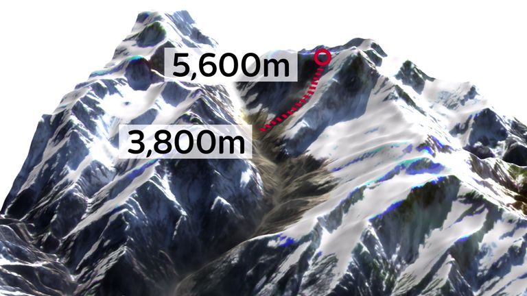
Image:It's thought the block fell 1800 metres into the valley below. Credit: Pic: Dr Scott Watson, COMET, University of Leeds
As it hurtled down the valley, the mass of fragmented rock ploughed through an ice deposit leftover from a 2016 avalanche in the area, leaving a trail of dust in its path.
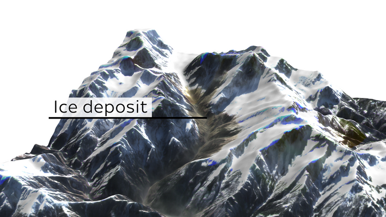
Image:The mass of rock and ice ploughed through a deposit of rock and ice from a 2016 avalanche. Pic: Dr Scott Watson, COMET, University of Leeds
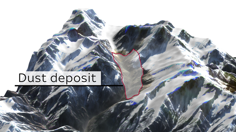
Image:The landslide left a huge trail of dust as it travelled down the valley. Pic: Dr Scott Watson, COMET, University of Leeds
"It was probably moving very fast. On the way it scooped up ice and rock debris from the valley floor," said Professor Dave Petley of Sheffield University.
"The ice was melted by the heat from the rock avalanche, so it changed into a debris flow. This scooped up water and sediment from the valley as it reached lower elevations. It was this huge flow that hit the dam sites."
Professor Petley was one of the first scientists to analyse the satellite imagery of the area in the following days, which was provided by Planet Labs.
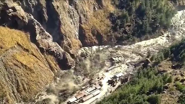
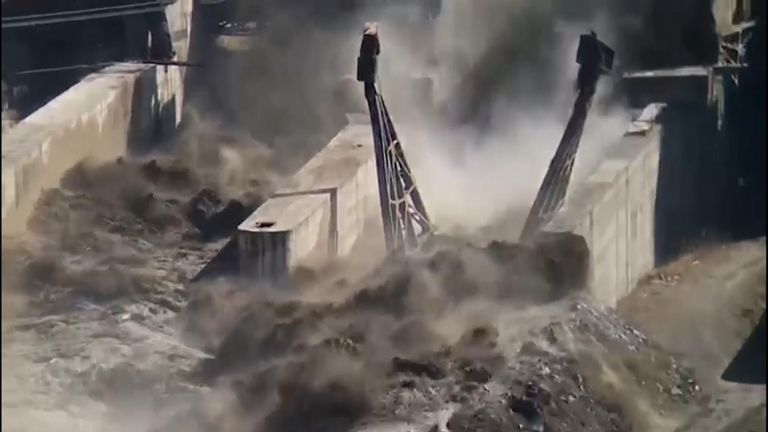
The colossal wall of water, rock and ice ploughed through the Rishiganga power project near Raini village, washing it away completely.
Please use Chrome browser for a more accessible video player
Did climate change cause India flood?
The manager of the project told Sky News that 40 of his workers are still missing after the disaster last Sunday.
The flood also severely damaged another hydropower project on the Dhauliganga River, close to Tapovan village. The mass of debris and mud trapped 37 workers on the project in a tunnel.
The dam was under construction at the time.
These images show the dam before and after the deluge hit.
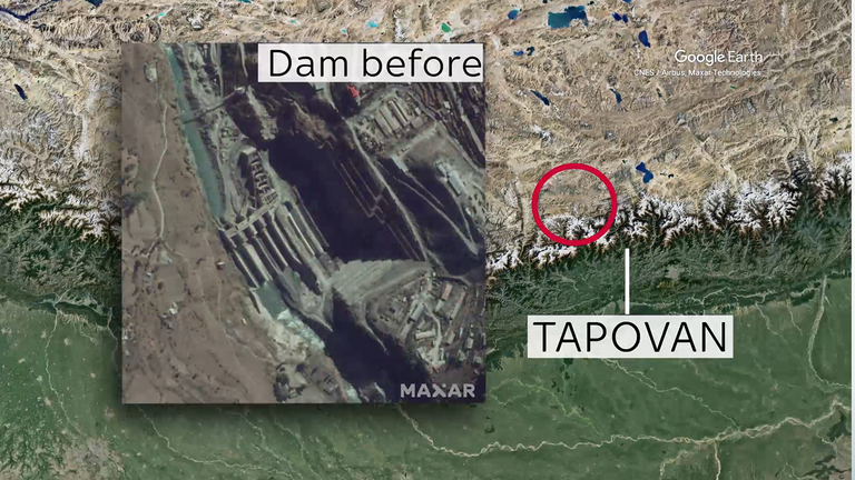
Image:This satellite image shows the Tapovan dam in 2018. Pic: Satellite image © 2021 Maxar Technologies
In this image after the disaster, the damage to the dam is clear even from space. Large parts of the dam have been destroyed, leaving only parts of it visible.
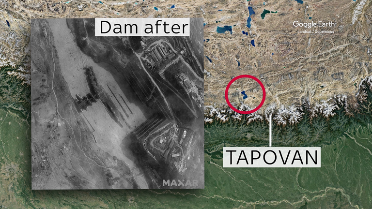
Image:This satellite image shows the Tapovan dam after the flood. Pic: Satellite image © 2021 Maxar Technologies
Due to the sheer volume of water that passed through the valley, some scientists initially thought the disaster was caused by what is known as a glacial lake outburst flood (GLOF).
That is when the dam surrounding a glacial lake fails, sending floods of water cascading into the valleys below.
Floods of this kind have become more frequent in the Himalayan region in recent years due to rising temperatures.
However, satellite imagery showed no evidence of a glacial lake in the area.
Professor Petley told Sky News: "Large floods down mountain valleys are often caused by GLOFs. At first sight it is hard to tell the difference between a GLOF and a landslide. People made an entirely reasonable assumption, but this was not correct."
While it is impossible to say that a specific event is the result of climate change, there is evidence to suggest that rising temperatures could have played a role in the incident.
The Columbia University LDEO study two years ago analysed satellite imagery of the Himalayan region over the past 40 years. It found lower-level glaciers in the area are shrinking by 5 metres annually.
These satellite images of the area taken in 1984 and 2016 illustrate the changing landscape in the region.
In this image from 1984, glaciers can be seen taking up a large proportion of the region.
Image:This satellite image shows the Himalaya region in December 1984. Pic: Google Earth Pro
But in this image, taken 32 years on, the white of the glaciers has dramatically reduced.
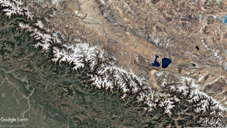
Image:Satellite imagery of the Himalaya region from December 2016. Pic: Google Earth Pro
Dr Scott Watson of Leeds University's Centre for Observation and Modelling of Earthquakes, Volcanoes and Tectonics (COMET) was one of the scientists who analysed the event through satellite imagery.
He told Sky News: "It's always difficult to try and attribute single events to climate change. What we can say is that the observed frequency of rockfalls and landslides in these high mountain environments has increased in the context of climate change and is expected to continue to increase.”
Professor Petley echoed these sentiments, telling Sky News: "The impact of climate change is that the ice in the fractures within the rock mass that forms the mountains is melting, especially in the summer months. This is weakening the mountains, leading to more of these events.
"There is really good evidence that this is happening - we can measure the ice in the fractures, we can record the number of collapses, etc. From high mountains around the world there is clear evidence that these large landslide events are becoming more frequent. We expect this to continue."