简体中文
简体中文

By APD writer Alice
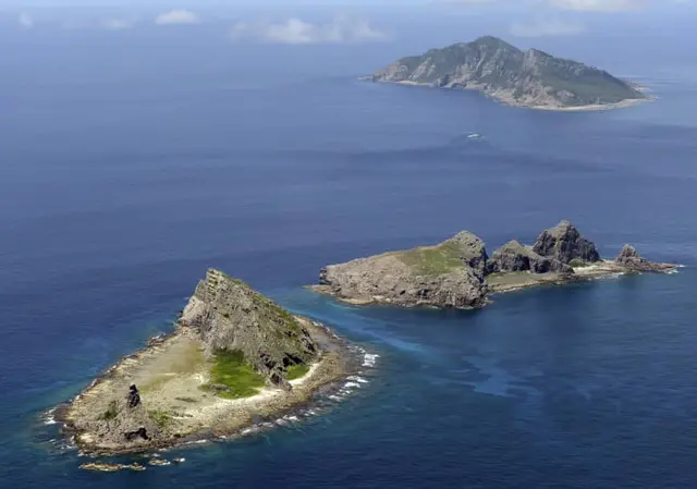
The Japanese government plans to build a central database to strengthen the monitoring of remote islands that define Japan’s territorial waters and exclusive economic zone, according to sources quoted by the Japan Times.
The database will list basic information on remote islands, such as the names and locations, together with image data from satellites, aerial photography and on-site investigations, the sources said on September 16.
The Cabinet Office and Japan Coast Guard will take the lead by compiling information from ministries and agencies starting no later than March 2020.
The plan addresses fears that Japan’s territorial waters could shrink if such islands sink beneath the ocean surface due to erosion and is designed to help detect changes in conditions to swiftly act against the risk of losing the islands.
According to the Cabinet Office, there are 484 remote islands around Japan’s borders, excluding the South Korean-controlled group of islets in the Sea of Japan known as Takeshima in Japan and Dokdo in South Korea and the Russian-held islands off Hokkaido called the Northern Territories in Japan and the Southern Kurils in Russia. The majority of them are uninhabited.
Last year, authorities received reports that Esambe Hanakita Kojima, an uninhabited islet located about 500 meters off the coast of Hokkaido, may have vanished, prompting the Coast Guard to start a probe.
“Many of the remote islands are hard to access, and in order to maintain them it is vital we understand their current state. We need to steadily compile data,” a government official said.
(ASIA PACIFIC DAILY)