 简体中文
简体中文

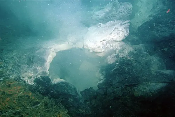
Researchers have explored more into the Axial Seamount, the most active undersea volcano in the northeast Pacific Ocean, and new findings may provide clues to better understand how and when terrestrial volcanoes erupt.
Axial, located some 300 miles, or about 480 kilometers, off the Oregon Coast on the U.S. Pacific Northwest, erupted in 1998, 2011 and 2015, the latter of which was forecast seven months in advance by researchers from Oregon State University (OSU), the Pacific Marine Environmental Laboratory at the U.S. National Oceanic and Atmospheric Administration (NOAA), and the University of North Carolina at Wilmington.
The key to the forecast was a gradual inflation of the seafloor created by intruding magma, said William Chadwick, an OSU volcanologist and co-author on two of the three new papers being published this week in Science and Geophysical Research Letters about details of the undersea volcano's workings.
"Axial inflates and deflates like a balloon, except it's filling with magma instead of air," Chadwick was quoted as saying by a news release from OSU on Thursday.
Following the 2015 eruption, Axial began re-inflating rapidly at first but the rate has been slowing. It has regained less than half of the eight feet, or 2.4 meters, of seafloor it lost during the 2015 eruption.
"We're beginning to really understand how this volcano works and some of these lessons can be applied to other volcanoes in a general way," Chadwick said. "During its eruptions, Axial's seafloor drops suddenly by about eight feet, and then over the next several years it gradually rises back up. When it re-inflates to a certain level, the volcano is almost ready to erupt again."
Axial Seamount is close to land, has a simple structure and is frequently active, yet not a hazard to people, prompting Chadwick to call it a "great natural laboratory."
"Ironically, in some ways we can learn more about how volcanoes work by studying them underwater because the seismic imaging works so much better in the oceans," he said.
"Previous surveys created the images of where the magma is and because ships can go everywhere over the volcano we get a lot more data. On land, you have to drill a hole, set off an explosion, and record it with a few scattered seismometers. It's not nearly as effective," he added.
The researchers have benefited from the Ocean Observatories Initiative, a program funded by the U.S. National Science Foundation to study the world's oceans that includes the Cabled Array, a network of sensors that helped make real-time seismicity and geodetic measurements. The instruments recorded a growing number of tiny earthquakes that increased from fewer than 500 a day to more than 2,000.
During the 2015 eruption, there were 600 earthquakes every hour, according to William Wilcock at the University of Washington.
(APD)